For Better Performance Please Use Chrome or Firefox Web Browser
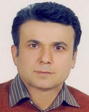
Dr. Ali Reza Soffianian
Associate Professor of Department
Search form
Search
English
فارسی
Welcome to Dr. Ali Reza Soffianian
No front page content has been created yet.
Office
: Isfahan University of Technology Department of Natural Resources
Email
: soffianian@cc.iut.ac.ir
Phone
: +98 313 3911011
Fax
: +98 313 3912840
Web Site
:
Ali Reza Soffianian
Associate Professor
Research Fields
:
Spatial planning
Landscape Ecology
Image Segmentation
Home
Biography
Publications
Research Projects
Teaching
Students
Laboratories
Experiences
Useful Links
Teaching
Systemic thinking in environmental management
Ecotourism
Land use planning
geographic Information Systems(GIS)
Recent Publications
Evaluating resampled and fused Sentinel-2 data and machine-learning algorithms for mangrove mapping in the northern coast of Qeshm island, Iran
Mapping disturbance in mangrove ecosystems: Incorporating landscape metrics and PCA-based spatial analysis
Assessing ecotourism in a mountainous landscape using GIS - MCDA approaches
Modeling Spatial Distribution of Carbon Sequestration, CO2 Absorption, and O 2 Production in an Urban Area: Integrating Ground-Based Data, Remote Sensing Technique, and GWR Model
Past and potential future distribution of white mangroves in an arid estuarine environment: Integration of Maxent and CA-Markov models
A hybrid GIS-OWA and DANP method for the identi?cation and evaluation of ecotourism attractions: the case study of Abbas Abad Wildlife Refuge, Iran
A hybrid GIS-OWA and DANP method for the identification and evaluation of ecotourism attractions: the case study of Abbas Abad Wildlife Refuge, Iran
Spatial modeling of land-use change in a rapidly urbanizing landscape in central Iran: integration of remote sensing, CA-Markov, and landscape metrics
Spatial modeling of land-use change in a rapidly urbanizinglandscape in central Iran: integration of remote sensing,CA-Markov, and landscape metrics
Analysis of multi-frequency and multi-polarization SAR data for wetland mapping in Hamoun-e-Hirmand wetland
Land Cover Classification in Mangrove Ecosystems Based on VHR Satellite Data and Machine LearningAn Upscaling Approach",
Comparing landscape suitability and permeability with and without migration data the influence of species movement behavior
Wetland Restoration Prioritization Using Artificial Neural Networks
Comparing different classification algorithms for monitoring mangrove cover changes in southern Iran
Human and Climate Effects on the Hamoun Wetlands
Road-induced fragmentation and the environmental value of roadless areas in a partly protected landscape in Central Iran
Wetland restoration prioritizing a tool to reduce negative effects of drought An application of multicriteria spatial decision support system (MC0SDSS)
Evaluating the statistical performance of less applied algorithms in classification of worldview-3 imagery data in an urbanized landscape
Scenario-based analysis of land-use competition in central Iran: Finding the trade-off between urban growth patterns and agricultural productivity
Impact of agricultural activities on accumulation of Cadmium, Cobalt, Chromium, Copper, Nickel and Lead in soil of Hamedan province
The study of thermal pattern changes using Landsat-derived land surface temperature in the central part of Isfahan province
Application of Remote Sensing in Monitoring Unsustainable Wetlands:Case Study Hamun Wetland
Exploring structural and functional corridors for wild sheep (Ovis orientalis) in a semi-arid area
Evaluating the spatial effectiveness of alternative urban growth scenarios in protecting cropland resources: A case of mixed agricultural-urbanized landscape in central Iran
A hierarchical approach of hybrid image classification for land use and land cover mapping
Habitat suitability mapping for sand cat (Felis margarita) iin Central Iran using remote sensing techniques
Drought analysis and time series of MODIS NDVI sattelite images Analysis to monitor the destruction of Vegetation in the Zayandehryd Basin
Habitat mapping as a tool for water birds conservation planning in an arid zone wetland: The case study Hamun wetland
Crop type mapping in a highly fragmented and heterogeneous agricultural landscape: A case of central Iran using multi-temporal Landsat 8 imagery
Evaluating the strategy of integrated urban-rural planning system and analyzing its effects on land surface temperature in a rapidly developing region
Monitoring land cover changes in Isfahan Province, Iran using Landsat satellite data
Monitoring landscape changes in Caucasian black grouse (Tetrao mlokosiewiczi) habitat in Iran during the last two decades
Wildlife Corridor as Conservation Management Tool to Mitigate the Impacts of Climate Change
Assessing the effects of changing grain size and extent on landscape metrics
Determining Air Pollution Potential Using Geographic Information Systems and Multi-criteria Evaluation: A Case Study in Isfahan Province in Iran
Change detection through four techniques using multi-temporal Landsat Thematic Mapper data: a case study on Falavarjan area, Isfahan, Iran
Geospatial modeling to identify the effects of anthropogenic processes on landscape pattern change and biodiversity
Inclusive Classification of recreational risk resources
Using the SLEUTH Urban Growth Model to Simulate Future Urban Expansion of the Isfahan Metropolitan Area, Iran
Risk assessment of heavy metal soil pollution through principal components analysis and false color composition in Hamadan province, Iran
Gradient analysis of urban landscape pattern, (Case Study in Isfahan, Iran)
Assessment of land cover changes & water quality changes in the Zayandehroud River Basin between 1997–2008
Mapping of human health risks arising from soil nickel and mercury contamination
Application of SWOT Analysis in Strategic Environmental Planning A Case Study of Isfahan/ Iran
Rangeland Degredation and its Impacts on Water Quality in Zayandehroud River Basin
Dispersion Modeling of NOx and SOx in Phase 9 and 10 of South Pars Oilfield
Predicting urban Expansion in Arak MetropolitanArea Using two Land Change Models
Analysis of Landscape Pattern Changes in Isfahan City during the Last Two Decades
Monitoring Land Use/Cover Changes Using Different Change Detection Techniques case study: Falavarjan area, Isfahan Iran
Dispersion Modeling of NOx and SOx in Phase 9 and 10 of South Pars Oilfield
Health Risks of Metals in Soil, Water, and Major Food Crops in Hamedan Province, Iran
Industrial Site Selection by GIS in Isfahan, Iran
Integration of remote Sensing data and GIS for prediction of land cover map
Multi objective land allocation (MOLA) for zoning GhamishlooH Wildlife
The relationship between land cover changes and spatial-temporal dynamics of land surface temperature
Spatiotemporal Changes of Zayandehroud River Water Quality in Response to Change in Landscape Patterns
The relationship between land cover changes and spatial-temporal dynamics of land surface temperature
Analysis of soil Heavy Metal Pollution and Landscape Pattern in Nahavand, Iran
Nickel and mercury human health risk assessment in Hamedan Province, Iran
Biological assessment of the Zayandeh Rud River Iran using benthic macroinvertebrates
Mapping and analyzing urban expansion using remotely sensed imagery in Isfahan, Iran
COMPARISON OF LAND COVERS CLASSIFICATION METHODS IN ETM+ SATELLITE IMAGES (CASE STUDY: GHAMISHLOO WILDLIFE REFUGE)
Biological assessment of Zayandeh Rud River, Iran, using benthic macroinvertebrates.
Water qulity assessment in an arid region using a water quality index.
Land use and land cover change dwtection of moute wildlife refuge using remote sensing and geographic information system
Studing of the MODIS data potentials to assess the pastureland production in the arid region of semirom-iran
Landfill site selection in the semi arid area of central Iran case study: Najafabad city, Iran
change detection of landscape ecology in Moteh wildlife refuge
Land use and land cover change detection of Mouteh wildlife refuge using remote sensing data and GIS.
Zonning the ghamishlo wildlife refuge by Multicriteria Evaluation (MCE) method
Urban land cover mapping using Aster Terra satellite image,a case study : Isfahan city,Iran
FOLLOW-UP OF ANZALI WETLAND, ON THE IRANIAN COAST OF CASPIAN SEA, A NECESSITY TO MAINTAIN WATER QUALITY
تحت نظارت وف ایرانی